

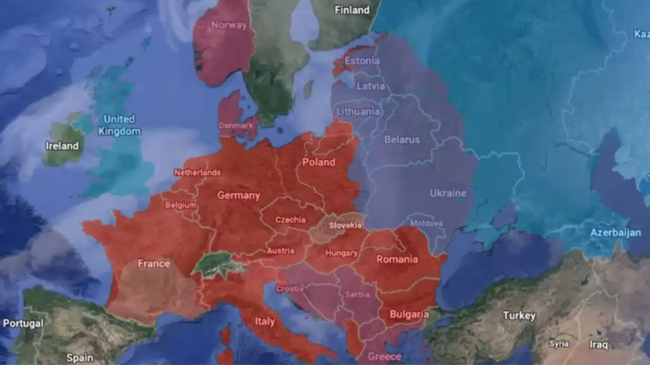
Google Earth Unveils Historical Imagery From World War II

Google Earth Historical Imagery World War II

Google Earth has just given history enthusiasts and geography lovers a reason to celebrate. The tech giant recently announced a major update that brings historical satellite and aerial imagery to the platform, dating back over 80 years.

This exciting addition allows users to explore key moments from the past, such as images of cities and landscapes during World War II.

A Walk Through Time

Previously, Google Earth introduced a timelapse tool that allowed users to view satellite images from 1984 to 2022, showing how different regions evolved over the decades. Now, this new feature extends even further back in time, covering the period starting from the 1930s.

With this update, users can now see areas like California reservoirs and major cities such as London, Berlin, and Warsaw during the early days of the Second World War.

For instance, we have added historical images of San Francisco from 1938, providing a unique comparison with its modern-day photos from 2022. This archival treasure trove opens up a deeper understanding of the changing cityscapes and landscapes over nearly a century.

Expanding Street View Around the World

In addition to historical imagery, Google is also expanding its Street View feature across nearly 80 countries. The latest update includes new photos of places like Logstor, Denmark, Oaxaca, Mexico, and Tasman, New Zealand. Google’s new lightweight camera technology has made the improved Street View captures possible.

The new camera, weighing just 15 pounds, is easy to mount on any car, enabling more extensive coverage of remote and previously inaccessible locations.

Currently, Street View hosts over 280 billion images from around the world, making it one of our planet’s most comprehensive visual records.

The Role of AI in Enhancing Imagery

Google has also integrated AI technology into its mapping tools to enhance the quality of the images. The company’s Cloud Score+ AI model helps remove common visual obstacles like mist, haze, and cloud shadows, delivering brighter and sharper images. Google Maps and historical images on Google Earth both exhibit this improvement, offering users clearer and more detailed visuals.

A Glimpse into the Past and the Future

With this update, Google Earth continues to evolve as a powerful tool for both history buffs and casual explorers. By offering historical imagery that dates back to World War II, Google is enabling users to travel back in time and witness significant moments in our world’s history from an entirely new perspective.

The combination of enhanced AI-powered visuals and expanded Street View features makes Google Earth a must-visit platform for anyone interested in seeing how our planet and its cities have transformed over the years.

This latest feature reinforces Google’s commitment to merging cutting-edge technology with historical insights, allowing us all to understand the past better while looking forward to the future.



Subscribe to Our Newsletter

Related Articles

Top Trending

Best Apps for Tracking Lost Luggage
10 Best Apps for Tracking Lost Luggage
Apps to Watch Movies
7 Apps for Watching Movies Together Remotely
Apps to Identify Songs
8 Apps to Identify Songs Playing Around You
Best AI Agents Small Businesses Can Use
10 Best AI Agents Small Businesses Can Deploy Today
Mobile Gameplay Recording Apps
8 Apps for Recording and Editing Mobile Gameplay

Technology & AI

Best Apps for Tracking Lost Luggage
10 Best Apps for Tracking Lost Luggage
Best AI Agents Small Businesses Can Use
10 Best AI Agents Small Businesses Can Deploy Today
How to Choose Immigration Case Management Software
Basketball Video Analysis Tools Coaches Use to Review Games
6 Video-Analysis Tools Coaches Use to Review Basketball Games
Small Claims Evidence Tools to Organize Your Case
7 Practical Tools for Preparing Evidence for a Small Claims Case

GAMING

Mobile Gameplay Recording Apps
8 Apps for Recording and Editing Mobile Gameplay
Esports Legal Issues Every Player Should Understand
9 Legal Issues Every Esports Player Should Understand
Basketball Video Analysis Tools Coaches Use to Review Games
6 Video-Analysis Tools Coaches Use to Review Basketball Games
Blockchain Gaming Features
10 Blockchain Gaming Features That Give Players More Control
Twitch Alternatives for New Game Streamers
10 Best Twitch Alternatives for New Game Streamers

Business & Marketing

Crypto Token Launch Marketing
Crypto Token Launch Marketing: From Pre-Sale, TGE, Listing to Post-Launch
data risks for installing free browser extensions
9 Data Risks When Employees Install Free Browser Extensions
Crypto and Blockchain Trends to Watch
10 Crypto and Blockchain Trends to Watch in 2026
marketing books that aged well
10 Marketing Books That Aged Surprisingly Well
Registered Agent Services to Compare Before Forming an LLC
6 Registered Agent Services to Compare Before Forming an LLC

EdTech & E-Learning

assistive technology in early learning
What is Assistive Technology in Early Learning: Examples and Benefits
best typing programs for kids
10 Best Typing Programs for Kids: Free and Paid Options That Teach Real Skills
homework help apps for kids
10 Best Homework Help Apps That Don’t Do the Work for Them
combine books and apps for deeper learning
8 Ways to Combine Books and Apps for Deeper Learning
how to talk to kids about online strangers
How to Talk to Kids About Online Strangers and Chat Features

Software & Apps

Best Apps for Tracking Lost Luggage
10 Best Apps for Tracking Lost Luggage
Apps to Watch Movies
7 Apps for Watching Movies Together Remotely
Apps to Identify Songs
8 Apps to Identify Songs Playing Around You
Best AI Agents Small Businesses Can Use
10 Best AI Agents Small Businesses Can Deploy Today
Mobile Gameplay Recording Apps
8 Apps for Recording and Editing Mobile Gameplay