
MH370 search resumes on 30 December 2025 as Malaysia authorizes Ocean Infinity to scan a new 15,000 km² area under a no-find, no-fee deal aimed at locating the Boeing 777 missing since 8 March 2014.
What Malaysia And Ocean Infinity Agreed To?
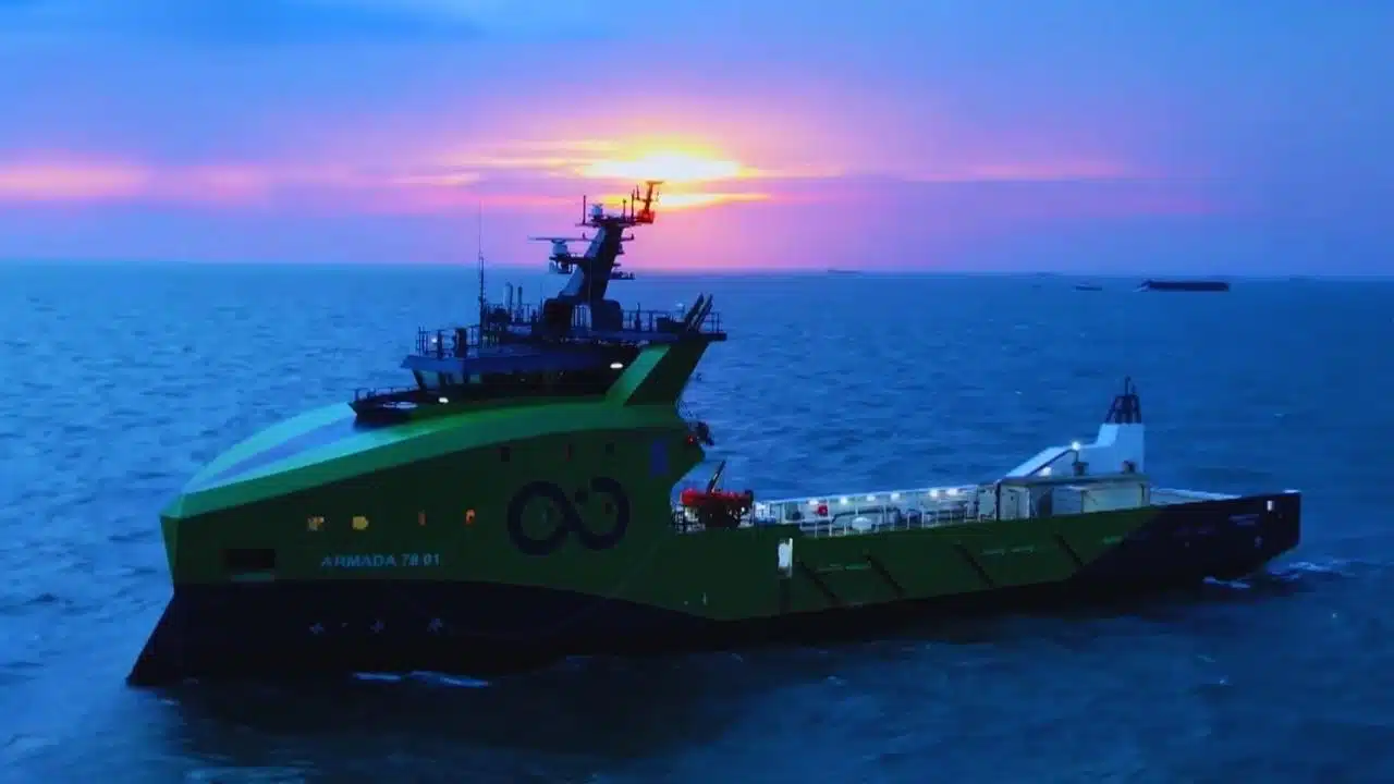
Malaysia has approved a renewed seabed search for Malaysia Airlines Flight MH370, giving marine robotics company Ocean Infinity permission to operate in a newly defined area of the southern Indian Ocean. The plan is designed to be narrower and more targeted than earlier hunts that covered vast stretches of remote ocean floor.
The Transport Ministry has said the deep-sea operation will resume on 30 December 2025. The company has confirmed it will conduct seabed search operations for a total of 55 days, and those days will be carried out intermittently rather than as one continuous run. That format reflects the realities of long-range deepwater work, where vessels must manage weather windows, equipment cycles, and operational constraints.
A key part of the deal is the payment structure. Malaysia is proceeding under a “no find, no fee” principle. Under this arrangement, the government does not pay if the aircraft is not found. The approved success fee is USD $70 million, payable only if the wreckage is located.
Malaysia has also emphasized the human purpose behind the decision: the government says it remains committed to seeking closure for families who have lived with unanswered questions for more than a decade.
Key Terms At A Glance
| Item | Confirmed Detail |
| Start date (resumption) | 30 December 2025 |
| Operational duration | 55 days (intermittent) |
| Search area | New zone, estimated 15,000 km² |
| Payment model | “No find, no fee” |
| Success fee | USD $70 million (only if wreckage is found) |
| Agreement timing referenced by Malaysia | Service agreement entered on 25 March 2025 |
This restart matters because MH370 is not a routine missing-aircraft case. It is one of the most complex and emotionally charged aviation mysteries of the modern era—partly due to the scale of previous searches, and partly because the aircraft’s main wreckage has never been publicly confirmed as located.
What We Know About MH370’s Disappearance?
Malaysia Airlines Flight MH370, a Boeing 777, disappeared on 8 March 2014 while flying from Kuala Lumpur to Beijing. There were 239 people on board—227 passengers and 12 crew—from multiple countries.
In the early portion of the flight, operations appeared normal. Later, communication and tracking data indicated the aircraft did not remain on its planned route. Authorities documented a loss of certain signals and later relied on multiple data sources to reconstruct an approximate path.
Investigators and officials have consistently stated that no definitive cause has been established in the public record. Without the main wreckage and flight recorders, the investigation has faced the same central limitation year after year: a shortage of hard physical evidence from the aircraft’s final moments.
What is publicly accepted, based on official search and investigation summaries over time, includes these broad points:
- MH370 deviated from its intended flight path.
- Analysis later supported the view that the aircraft continued flying for hours after it was last tracked in routine ways.
- The most widely accepted end area has been the southern Indian Ocean, where authorities believe the aircraft likely ended its flight.
Over the years, fragments believed to be linked to MH370 have been recovered along the western Indian Ocean rim. The most well-known is the wing flaperon found on Réunion Island in July 2015, later linked to a Boeing 777 from the missing aircraft’s type and configuration. Other pieces believed to be from the aircraft were reported along parts of the African coast and Indian Ocean islands, though the overall set of recovered items has never replaced the need to locate the main wreckage.
Timeline Of A Mystery That Has Spanned More Than A Decade
| Date | Milestone |
| 8 March 2014 | MH370 disappears during Kuala Lumpur–Beijing flight with 239 on board |
| 2014–2017 | Major multinational underwater search conducted in the southern Indian Ocean |
| January 2017 | Governments announce suspension of underwater search pending new credible evidence |
| July 2015 (mid-period) | Flaperon found on Réunion Island, later linked to MH370’s aircraft type |
| 2018 | A renewed privately led seabed search takes place but ends without locating the wreckage |
| 19 March 2025 | Malaysia approves terms for a new Ocean Infinity search in a 15,000 km² area |
| 30 December 2025 | Malaysia says the new 55-day intermittent seabed search will resume |
This updated search now sits at the intersection of two realities: the technical challenge of surveying extreme depths, and the continuing demand for answers from families, aviation safety experts, and the public.
Where Earlier Searches Looked And Why They Came Up Empty?
The scale of previous MH370 searches is one reason the case remains so significant. The international underwater search effort that followed extensive surface searching became one of the largest and most demanding deep-sea hunts in history.
A multinational effort led by Australia’s transport safety authority, working with Malaysia and China, surveyed large areas of the southern Indian Ocean. Over time, the hunt relied on refined models of likely flight paths, plus analysis of satellite communication data that suggested a long flight after the aircraft left its planned route.
Despite years of work and significant expenditure, the underwater search did not locate the main wreckage. By mid-2018—after a second major private search attempt—the total seafloor searched was described as close to 200,000 square kilometres in combined efforts, without locating the aircraft.
That outcome does not necessarily mean the aircraft is not in the region. It highlights how difficult deep-sea detection can be when:
- The probable search zone spans thousands of kilometres,
- Seafloor terrain includes ridges, trenches, and complex topography,
- Debris may be scattered or partially buried,
- Sensor interpretation can be complicated by natural features that resemble manmade shapes on sonar.
Another challenge is that search planning is built on models—best estimates based on data points that are incomplete by definition. Search teams have had to infer likely routes and end points from indirect evidence, then choose which areas offer the highest probability per square kilometre.
What Past Search Results Suggest?
| Observation | Why It Matters |
| Vast seafloor area scanned without a confirmed wreck site | The probable zone may still be partially outside previously scanned corridors |
| Seafloor conditions are extreme | Deepwater terrain can obscure debris and complicate sonar interpretation |
| Some debris believed linked to MH370 washed ashore far away | Drift patterns can support a southern Indian Ocean end area but cannot pinpoint a crash site alone |
| Lack of flight recorders and primary debris field | Investigators cannot confirm final events with certainty without the main wreckage |
The renewed search is therefore not simply “starting over.” It is attempting to be more surgical—reducing the search footprint while aiming to increase the probability density within that footprint.
What Is Different About The New 15,000 km² Zone And The Technology?
The biggest operational difference is the size and selection of the search area. Malaysia’s approval focuses on a new 15,000 km² zone described as the targeted area assessed to have the highest probability of locating the aircraft. In practical terms, this implies that the search team and its partners believe newer analysis can narrow down where MH370 is most likely to be.
Just as important is the technological evolution in deep-sea search operations since the earlier missions. Modern seabed searches typically rely on high-resolution sonar mapping, coupled with autonomous underwater vehicles (AUVs) that can operate at great depths for long periods.
In general, current-generation AUV-led surveys can offer advantages such as:
- Higher-resolution seabed mapping that improves identification of small or partially buried objects.
- Improved endurance that allows longer missions per dive, increasing effective coverage.
- Better navigation and route planning for systematic scanning and targeted re-scans.
- More mature data processing using refined pattern recognition and human review workflows.
The “intermittent” 55-day plan also matters. Deepwater search conditions in the southern Indian Ocean can be harsh, with weather and sea state playing a decisive role. An intermittent schedule can allow the operator to work within safer windows while still meeting an overall operational total.
How A Focused Search Can Improve Odds?
| Strategy Shift | Practical Effect |
| Smaller search box | More time per square kilometre and more repeat-checking of anomalies |
| New “highest probability” area selection | Concentrates resources where updated modelling suggests the strongest likelihood |
| Advanced AUV operations | Enables detailed scanning in deep or complex seafloor terrain |
| Faster analysis cycles | Helps teams revisit “points of interest” before leaving an area |
Malaysia has not publicly disclosed detailed coordinates in its key announcements. That choice is common in sensitive operations, where publicizing precise polygons can create security, safety, or operational concerns, and can also intensify public speculation before findings are confirmed.
It is also important to be clear about what “finding MH370” means in contract language. In most practical aviation terms, “success” generally implies identifying wreckage in a way that is verifiable—typically through imaging or physical evidence that can be tied to the aircraft—rather than ambiguous sonar shapes alone. Verification standards matter because this case is both technical and emotional: families want certainty, and investigators need evidence that can withstand scrutiny.
What Happens Next And What Finding The Wreckage Would Mean?
The next phase is operational a 55-day intermittent seabed scan beginning 30 December 2025 in the selected target zone. The most immediate “what comes next” is not recovery—it is detection and confirmation.
If the search identifies a credible debris field or wreck structure, the process usually follows a careful sequence:
- Detection (sonar mapping reveals anomalies),
- Classification (analysts compare shapes and patterns against known seafloor features),
- Verification (higher-resolution scans and/or visual confirmation),
- Reporting and validation (sharing evidence with authorities to confirm aircraft identity),
- Decisions on recovery (what to retrieve, how, and at what cost and risk).
Finding the wreckage could change the MH370 case in several concrete ways:
- A confirmed crash location would narrow uncertainty and allow stronger drift back-modelling for debris already found.
- The debris field pattern could provide clues about impact dynamics and breakup sequence.
- Potential recovery of flight recorders could help determine what happened in the final hours—though recovery feasibility depends on depth, condition, and location.
- Improved safety learnings could emerge even if the recorders are not intact, depending on what components are recovered and analyzed.
At the same time, it is realistic to acknowledge what a discovery may not deliver. Even with wreckage located, recovery could be technically difficult, expensive, and slow. And the public may not get immediate answers if evidence requires months of analysis.
Still, the renewed search is significant because it reflects Malaysia’s willingness to continue pursuing resolution through a results-based agreement. It also signals confidence—at least at the planning level—that the current target zone has been selected using stronger probability assessment than in earlier phases.
MH370 search resumes with a tighter search footprint, upgraded deep-sea survey capability, and a contract structured to pay only if the aircraft is found. For families, the restart renews hope for a verified location after more than a decade of uncertainty. For aviation safety, it is another chance to secure evidence that could finally explain one of the most enduring mysteries in modern flight.