
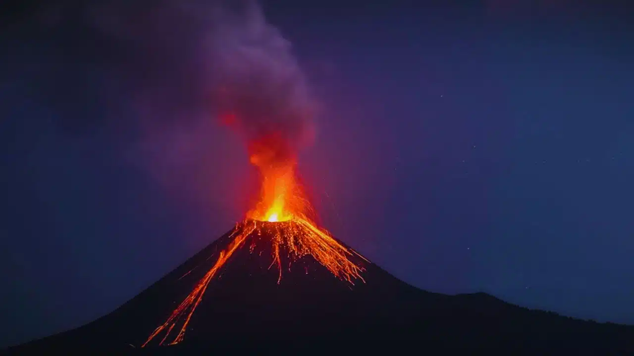
India’s only active volcano, located on Barren Island in the Andaman Sea, has erupted not once but twice within just a week. According to official reports, the first eruption took place on September 13, 2025, followed by another on September 20, 2025.
Though both events were classified as minor eruptions, their close timing makes them significant. They mark the fifth and sixth eruptions of Barren Island since the volcano reawakened in 1991 after lying dormant for more than 200 years.
Authorities confirmed that no ash clouds reached nearby populated areas, and the eruptions posed no immediate danger to residents of the Andaman and Nicobar Islands. However, scientists emphasize that even small eruptions need careful monitoring, as they may signal deeper geological changes.
The Role of the Earthquake
One striking detail about the September 20 eruption is that it came only two days after a magnitude 4.2 earthquake struck the Andaman Sea on September 18.
Experts suggest that this earthquake, which occurred along the boundary of the Indian Plate and the Burma (Myanmar) Microplate, may have disturbed magma chambers beneath Barren Island. Seismic activity often interacts with volcanic systems, either accelerating an eruption or intensifying existing pressure.
Geologists have pointed out that the West Andaman Fault—a tectonic fault line in this region—is directly linked with past mega-events, including the 2004 Indian Ocean earthquake and tsunami. This makes any new activity around Barren Island scientifically important, even if the immediate eruption appears small.
A Volcano with a Long, Restless History
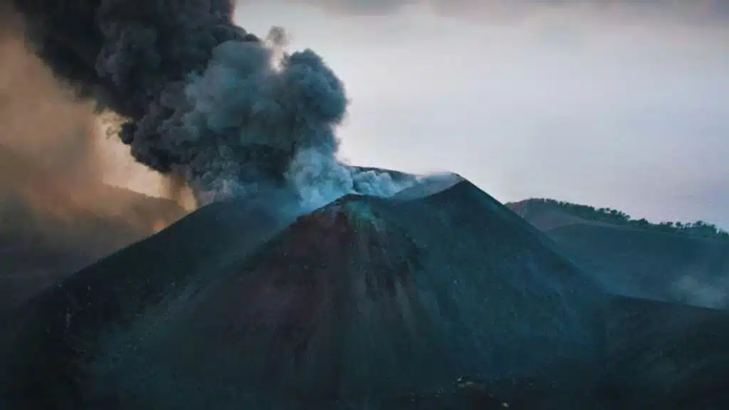
भारत का इकलौता सक्रिय ज्वालामुखी #BarrenIsland फिर सक्रिय हो गया है.
यह ज्वालामुखी अंडमान और निकोबार द्वीपसमूह के पूर्वी हिस्से में है.#IndianNavy के एक युद्धपोत से एक वीडियो रिकॉर्ड किया गया है जिसमें ज्वालामुखी से लावा और धुंआ निकलते देखा जा सकता है.
बैरन आइलैंड भारत ही… pic.twitter.com/swsiQnwbCg
— SansadTV (@sansad_tv) September 22, 2025
First Recorded Eruption
Historical records trace the first eruption of Barren Island back to 1787, documented by British administrators. Since then, eruptions have been noted intermittently over the centuries.
The Dormancy Period
After the 19th century, the volcano went silent for over 200 years. Scientists believed it was dormant—until it suddenly roared back to life in 1991 with a major eruption that dramatically altered the island’s landscape.
Recent Activity
Since its 1991 reawakening, Barren Island has erupted several times:
- 1994–95: Minor explosive activity.
- 2005–2007: Renewed eruptions following the 2004 tsunami.
- 2017–18: Frequent mild eruptions with lava flows visible at night.
- 2022: A short eruptive phase.
- 2025: Two eruptions in one week, raising fresh concerns.
This long history suggests that Barren Island is not just a dormant geological relic but part of an active volcanic arc stretching between Sumatra and Myanmar.
The Geography of Barren Island
- Location: About 140 km northeast of Port Blair, the capital of the Andaman and Nicobar Islands.
- Size: Roughly 3 km wide, with a central 1.6 km-wide caldera formed by past explosive eruptions.
- Population: True to its name, the island is uninhabited. Its harsh environment supports only limited life—mostly goats introduced by sailors, some species of birds, and flying foxes.
- Access: Indian authorities restrict visits, though scientists and occasionally tourists on chartered boats observe the volcano from a safe distance.
Why the Eruptions Matter
Scientific Concerns
Even though the September eruptions were mild, they highlight important concerns:
- Seismic-volcanic interaction: The link between the earthquake and eruption could signal stress changes deep underground.
- Hazard monitoring: While the island is uninhabited, larger eruptions could disrupt air travel or shipping lanes in the Andaman Sea.
- Tsunami risk awareness: The region’s connection to the 2004 disaster keeps scientists alert to any geological activity.
Global Importance
Volcanoes like Barren Island also play a role in understanding:
- Plate tectonics: The interaction between the Indian Plate and Burma Microplate.
- Climate studies: Even minor eruptions release gases like sulfur dioxide, which can affect atmospheric chemistry.
- Regional preparedness: Monitoring these eruptions helps authorities build better disaster management strategies for the Andaman and Nicobar Islands.
Monitoring and Future Outlook
Scientists from the Indian National Centre for Seismology (NCS) and the Andaman and Nicobar administration are closely tracking the volcano using:
- Seismographs to detect underground tremors.
- Satellite imaging to monitor gas emissions and thermal activity.
- Aerial surveillance for visual confirmation of lava and ash activity.
So far, no large-scale ash plumes or lava flows have been reported. However, volcanologists caution that the recent double eruption could mean the volcano is entering another active phase.
Authorities continue to stress that there is no immediate danger to local populations, but vigilance is essential given the region’s seismic sensitivity.
Barren Island remains one of India’s most fascinating and closely watched natural features. Its two eruptions in September 2025 remind us that even small volcanic events can carry important warnings about the Earth’s restless interior.
While the island itself is barren and uninhabited, the volcano’s location—at the meeting point of major tectonic plates—makes it a critical site for scientific study and disaster preparedness. For now, life in the Andamans goes on without disruption, but geologists will keep a careful eye on India’s only active volcano in the weeks and months ahead.