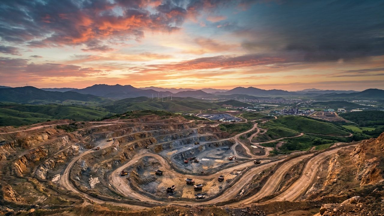
Recent research reveals a surprising connection between climate shifts and geological unrest in East Africa, showing how drying conditions thousands of years ago amplified earthquakes and volcanic activity around Kenya’s Lake Turkana. Scientists from the University of Auckland and Syracuse University published their findings on November 10, 2025, in Scientific Reports, demonstrating that a drop in the lake’s water levels by 100 to 150 meters between 4,000 and 6,000 years ago accelerated fault slipping by an average of 0.17 millimeters per year. This discovery upends the traditional view that the East African Rift System’s continental rifting stems entirely from deep mantle forces, highlighting instead how surface changes like rainfall and evaporation can influence these processes.
The rift, a massive tectonic feature stretching over 3,000 kilometers from the Red Sea to Mozambique, marks where the African continent is gradually pulling apart at a rate of about 6 to 7 millimeters per year, creating a landscape of dramatic valleys, volcanoes, and lakes. Lake Turkana itself, the world’s largest permanent desert lake spanning roughly 250 kilometers in length and up to 30 kilometers across, formed around 2 million years ago when volcanic activity blocked its natural outflow, trapping ancient waters in a basin that’s now a hotspot for seismic events.
With average annual rainfall under 250 millimeters and intense evaporation from hot winds, the lake’s levels have always been precarious, making it an ideal site to study climate’s role in tectonics. The researchers emphasize that while human-induced climate change today operates on faster timescales, these ancient patterns offer clues to potential future risks in vulnerable rift zones.
How Water Levels Affect Earthquakes?
To uncover this link, lead author James Muirhead from the University of Auckland and co-author Christopher Scholz from Syracuse University meticulously analyzed 27 underwater faults in the remote South Turkana Basin, using high-resolution seismic imaging and sediment core samples to reconstruct tectonic history. They focused on two key periods: the relatively wet Late African Humid Period, spanning about 9,600 to 5,300 years ago, when higher lake levels stabilized the crust, and the subsequent drier era that followed as global climates shifted post-Ice Age. During the humid phase, the lake’s elevated waters—sometimes over 90 meters higher than today—exerted substantial downward pressure, suppressing fault movements and limiting magma flow beneath the surface. But as aridity set in around 6,000 years ago, driven by weakening monsoons and orbital changes in Earth’s tilt, the lake receded dramatically, triggering a cascade of geological responses.
This reduction in weight on the crust, akin to lifting a heavy load from a trampoline and watching it rebound, made underlying faults more prone to slipping, increasing seismic activity across the basin. More profoundly, the lighter load eased pressure on the asthenosphere—the semi-molten layer below the crust—promoting partial melting of rocks and generating extra magma that intruded into chambers under nearby volcanoes like those in the Ethiopian Highlands. This magma buildup not only fueled eruptions but also lubricated faults, accelerating rifting by injecting fluids that weaken rock cohesion. Muirhead described the scale of this effect as astonishing, noting that such a modest water-level change—mere hundreds of meters in a lake over 200 meters deep—could alter fault rates so noticeably, providing the first direct evidence of climate-driven tectonics in the East African Rift.
Comparable dynamics appear elsewhere in Iceland, post-glacial rebound from melting ice sheets has spiked quake frequency since the 19th century, while in California’s Sierra Nevada, vanishing snowpack has correlated with heightened seismicity in fault zones. The team’s fieldwork was grueling, involving dragging boats across desert terrain to reach the lake’s isolated shores, where no emergency services exist, and deploying echo sounders to map faults hidden under murky, alkaline waters teeming with Nile crocodiles and hippos. These efforts yielded the most detailed slip-rate records for the rift over the past 10,000 years, showing fault activity surging by up to 50% during low-water phases. Lake Turkana’s volatile hydrology, influenced by inflows from the Omo River and seasonal winds, has seen levels fluctuate by over 100 meters multiple times in the Holocene, underscoring its role as a natural laboratory for climate-tectonic interactions.
Links to Human Evolution and Today’s Risks
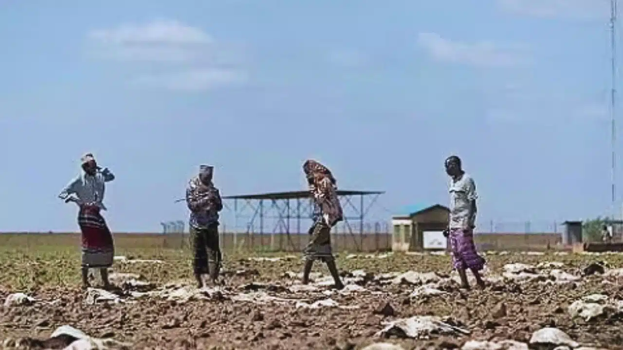
Nestled in the East African Rift Valley, Lake Turkana’s fossil-laden sediments have earned it the moniker “cradle of humanity,” preserving a 4.2-million-year timeline of human evolution from early australopithecines to Homo erectus, including iconic finds like the 1.6-million-year-old Turkana Boy. The study implies that during arid intervals like the one 4,000 to 6,000 years ago, early hominins and their predecessors navigated not only scarce resources and expanding savannas but also intensified earthquakes and eruptions that reshaped rivers, created barriers, and altered migration routes. For instance, heightened volcanism could have blanketed landscapes with ash, disrupting foraging and forcing adaptations in tool use or social structures amid unstable terrain.
Scholz, a veteran rift explorer, argues this reveals rifting as a hybrid process, blending plate tectonics with hydrological cycles, and calls for rethinking how environmental stressors molded human resilience. On modern fronts, the research warns that ongoing climate change—through altered precipitation and evaporation—could subtly elevate volcanic and seismic probabilities in East Africa, though these shifts unfold over millennia rather than decades, making them hard to detect in short-term records. The region already faces frequent quakes, like the 5.9-magnitude event near Lake Turkana in 2018, and active volcanoes such as Ol Doinyo Lengai, which spews unique carbonatite lava. Yet, counter to earlier drought fears, updated climate models from the IPCC now project Lake Turkana rising by up to 20 meters over the next two decades, fueled by intensified Ethiopian rains boosting Omo River inflows amid a warming atmosphere.
This reversal poses new threats flooding could submerge communities, erode shorelines, and even threaten archaeological sites, as rising waters have already buried parts of the basin’s heritage, prompting initiatives like Kenya’s National Museums training programs to map and preserve fossils before they’re lost. Increased water might dampen some fault activity by adding crustal load, but it heightens erosion risks and could redirect magma pathways unpredictably. Muirhead urges comprehensive hazard mapping for rift faults, integrating real-time climate data, water volumes, and satellite monitoring to predict quake odds more accurately, especially as population growth strains the valley’s 14 million residents.
Building on prior work, such as sediment studies showing lake highs during the African Humid Period tied to stronger monsoons, this research stresses the interconnectedness of Earth’s systems—climate, water, and geology—and advocates for resilient planning in rift-prone areas worldwide. Ultimately, it serves as a reminder that human actions amplifying climate variability could ripple through the planet’s deep foundations, demanding proactive science to safeguard both history and future.
The information is collected from Perplexity and Phys.org.